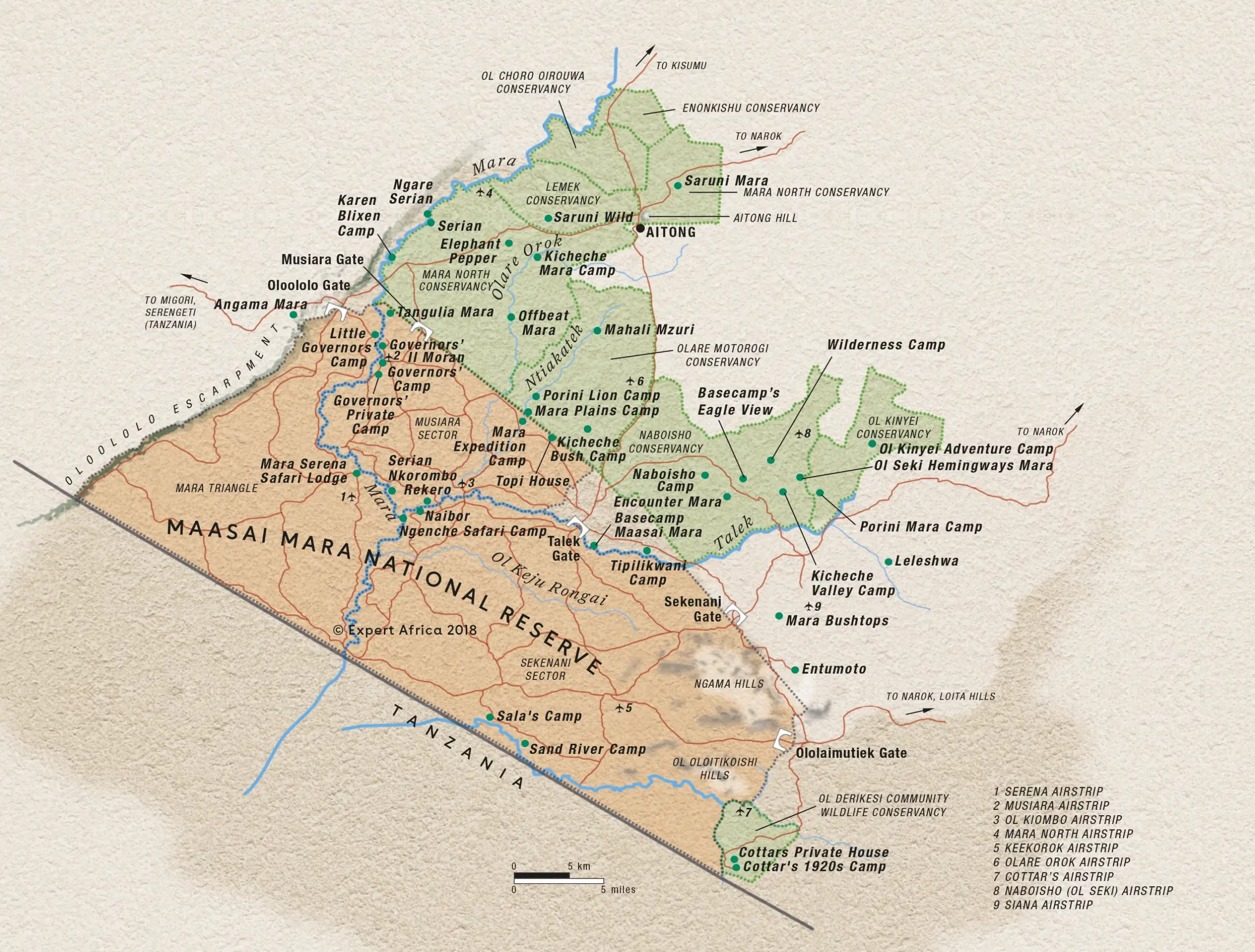
Masai Mara Map
Here is a detailed map of the Masai Mara, showcasing both the main Masai Mara National Reserve and the surrounding conservancies, which visitors can download for free. The heart of the park is divided into two sections: the Eastern side located in Narok County and the Western side, known as the Mara Conservancy, situated in Trans-Mara County. Additionally, the map includes the nearby Masai Mara Conservancies, such as Mara North, Siana, Lemek, Koiyaki, Naboisho, Olare Orok, and Ol Kinyei. These areas are renowned for their rich wildlife and are a must-see for anyone planning a Masai Mara safari adventure.
Comprehensive Masai Mara Map Featuring Airstrips, Hotels, Camps & Lodges
The Masai Mara Map shown here highlights the general locations of key accommodations, including permanent tented camps, lodges, and select campsites. Keep in mind that the map isn’t to scale, so if you require precise coordinates or exact positions, feel free to reach out to us. For a more detailed view, check out the Google Maps link. This map is a handy tool for planning your Masai Mara safari adventure, helping you explore the stunning landscapes of the Masai Mara National Reserve, spot the majestic wildlife, and experience the unique culture of the Maasai people. Whether you’re interested in the wildebeest migration, the Mara River, or the Mara Triangle, this map will guide you through the wonders of southwestern Kenya.